View Larger Map
 |
| cross blackfeet indian reservation |
9:30 left campground, drove along the park's only main road --- Going-to-the-Sun
Road, down on the road, we saw an unknown
Creek, the river is cyan, extremely clean. Washed down from the upper reaches
of the river is very rapid, playing numerous white splashes on the stones in
the river. This blue river, white spray viewing and wooden stairs, ride
together, as in the painting.
Line to the Avalanche Creek (almost one-third of the entire
Going-to-the-Sun Road,) closed to traffic, all vehicles where park ranger explained that last night rock collapsed, so
the road until late in the afternoon some time to restore access. This can be
hard for us, but why the park has only one road.
Alternatively, we went for boating in Mcdonald lake, not far
from the visitor center (Apgar Visitor Center) . Crystal clear blue of the
lake, the two sides isolated and rugged mountains and canyons throughout, the
magnificent icebergs, shade trees, blue / gray / green fusion together, dream
like really seems to be not real. We also see the campground last night.
Afternoon driving on Highway roads suffered a big traffic
jam, simply we changed route to drive through the Indian Reservation, this protected area called black feet india
reservation. Into the protected area is a gravel road, only enough for two
vehicles, two-way traffic, unpaved, drove up on the dusty. After entering the
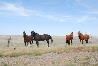
protected area, see open terrain, cattle and horses are on the backyard
hillside. Indian men occasionally drove over, really.
18:40 to reach 15 Highway and 90 Highway junction point here
is the American continental dividing
line .
We stayed at Dillon, MT to have laundry, food.


.jpg)


